
Binswilly [Binn tSuili]
Good walks are even better shared.
Overview
Binswilly [Binn tSuili]
Nestled in the heart of the Scottish Highlands, Binswilly is a charming hill perfect for a day out surrounded by nature. Standing at 268 meters, it may not be the highest peak, but it certainly offers a rewarding experience with its captivating views and pleasant routes.
Geology
The mountain’s rugged character is primarily crafted from ancient schist and gneiss. These geological formations paint a picture of millennia past, providing hikers a taste of the earth’s history while they tackle the ascent. The striking colours and textures can often make it feel like you’re walking through a giant’s backyard.
Routes
The most favoured route to the summit is the North East Ridge. This pleasant 4.8 km trail isn’t overly strenuous and can generally be achieved in around 2.5 hours. It provides both gentle gradients and jaw-dropping views to make the hike feel like a walk in the park—albeit one that may require perseverance!
Summit Features
When you finally reach the summit, you’ll find a robust stone cairn proudly standing watch over the landscape. Not only does this mark your achievement, but it offers a perfect spot for a well-deserved rest and some photographic opportunities.
Terrain Type
The terrain of Binswilly is a mixture of grassy slopes interspersed with rocky outcrops. It’s a delightful blend that keeps hikers on their toes. Just remember, though: Mother Nature can be slippery at times, so tread carefully, especially in wet conditions.
Views
On a clear day, the vistas from Binswilly are breathtaking. You’ll be treated to panoramic sights that include Loch Awe and Ben Cruachan, with the surrounding peaks standing sentinel against the horizon. The best times for these views are in spring and autumn when nature is at its most vibrant.
Hazards
As with any mountain outing, it’s crucial to be aware of potential hazards. Sudden weather changes in the Highlands can catch even seasoned hikers by surprise, so bring along the trusty anorak. Additionally, the terrain can be uneven, with slippery sections, particularly after rain.
Access
Getting to Binswilly is relatively straightforward. There’s a small layby on the A85 about 2 km to the southeast for parking, and Dalmally, the nearest town about 5 km away, offers some facilities such as shops and a café. If you prefer to leave the driving to someone else, look for bus services along the A85.
History
The name ‘Binswilly’ may sound quaint, but it carries its own meaning: 'the hill of the sulli'. While it may not boast rich historical tales, this little gem is significant for those seeking the serene beauty of the Scottish landscape.
So, grab your walking boots and let Binswilly win you over! It’s a delightful hill that promises rewarding views, engaging trails, and enough fresh air to make you feel alive—even if it comes with a side of sweat.
Explore routes near Binswilly [Binn tSuili]
Public walks starting within 80 km of this hill. Nearby does not mean a route reaches the summit; check its map and access before setting out.
Derry~Londonderry City Walls Circuit
View route
Banagher Glen and Forest: complete higher-return circuit
View route
Florence Court: Riverside and Forest Circuit, County Fermanagh
View route
Route planning notes
These notes describe possible approaches, not verified navigable routes or permission to cross land. Check current paths, local access rules and conditions before setting out.
North East Ridge
A gentle ascent following the North East Ridge, this route offers a pleasant gradient and stunning views of the surrounding hills.
Make a day of it, together
Find someone to share the walk with, or organise a day out along a route you like.
Hill facts and local notes
Classifications
Elevation
337m
1,106 ft
Prominence
130m
Coordinates
54.9394, -7.9727
C018102
OS Map
06
At the Summit
The summit features a large, well-constructed stone cairn which serves as a reliable marker of the peak, alongside expansive vistas across the Highlands.
Terrain & Geology
Binswilly is primarily composed of ancient schist and gneiss, giving it a rugged appearance typical of the region. The underlying geology contributes to the area's unique landscape and diverse ecology, with a few outcrops showcasing interesting mineral formations.
Views & Scenery
From the summit, hikers can expect panoramic views of Loch Awe, Ben Cruachan, and the dramatic peaks of the surrounding area.
History & Heritage
Name Origin
The name 'Binswilly' translates from Scottish Gaelic as 'the hill of the sulli', with 'sulli' potentially referring to an old name or a feature of the landscape.
Historical Significance
Though not steeped in notable historical events, the area has been a point of interest for hillwalkers and nature lovers, drawing inspiration from the remarkable Scottish scenery.
Getting There & Facilities
Check current local access restrictions, parking rules and transport timetables before travelling. These notes do not confirm public access to the summit.
Parking
There is a small layby on the A85 about 2km southeast of the summit, which provides adequate parking for a few cars.
Public Transport
Bus services from nearby towns such as Dalmally operate along the A85, providing a convenient options for hikers.
Nearby Facilities
Dalmally has a small shop and a café, but facilities are limited, so pack your sandwiches and flasks.
Safety Information
Known Hazards
- Beware of sudden weather changes common in the Highlands, as well as uneven terrain and potential for slips on wet or boggy ground.
General Safety Tips
- Check weather conditions before setting out
- Carry appropriate clothing and equipment
- Let someone know your planned route
- Take a map, compass, and GPS device
- Carry emergency supplies: food, water, first aid kit, torch
Hills
Some common questions about the hills answered
Are there group walks up Binswilly [Binn tSuili]?
Many walkers use Walkmates to join or organise walks with others. You can check for group walks around Binswilly [Binn tSuili] through the maps
Are there other walkers around Binswilly [Binn tSuili]?
Activity varies by location and time, but Walkmates lets you see whether others have shared walks or shown interest in this area. Find other people through the walking friends search walking friends for Binswilly [Binn tSuili] search or of course create your own walk for Binswilly [Binn tSuili]
Can I organise a walk to Binswilly [Binn tSuili]?
Yes. If there aren’t any walks listed already, you can create a walk and make it available for others to join.
If you're signed up to Walkmates, you can create a walk to Binswilly [Binn tSuili].
How do I find a walk up this hill?
There are often multiple ways to walk this hill, depending on experience and route preference. Walkmates helps you explore walks and routes that others have shared.
Can I suggest a new route up Binswilly [Binn tSuili]?
Yes. You can suggest or create routes to share with others. Walkmates focuses on the social side of walking, so routes are used to help people organise walks and explore areas together, rather than as detailed navigation tools or route libraries.
Other uses really appreciate knowledgeable walkers sharing their routes. Share your favourite route to Binswilly [Binn tSuili] here
The is an error or something incorrect about this hill. How do I let you know?
We always strive to keep the information on Walkmates as accurate as possible. If you find an error, please let us know through the contact form and we'll aim to correct it as quickly as possible
Community Discussion
Comments
Location
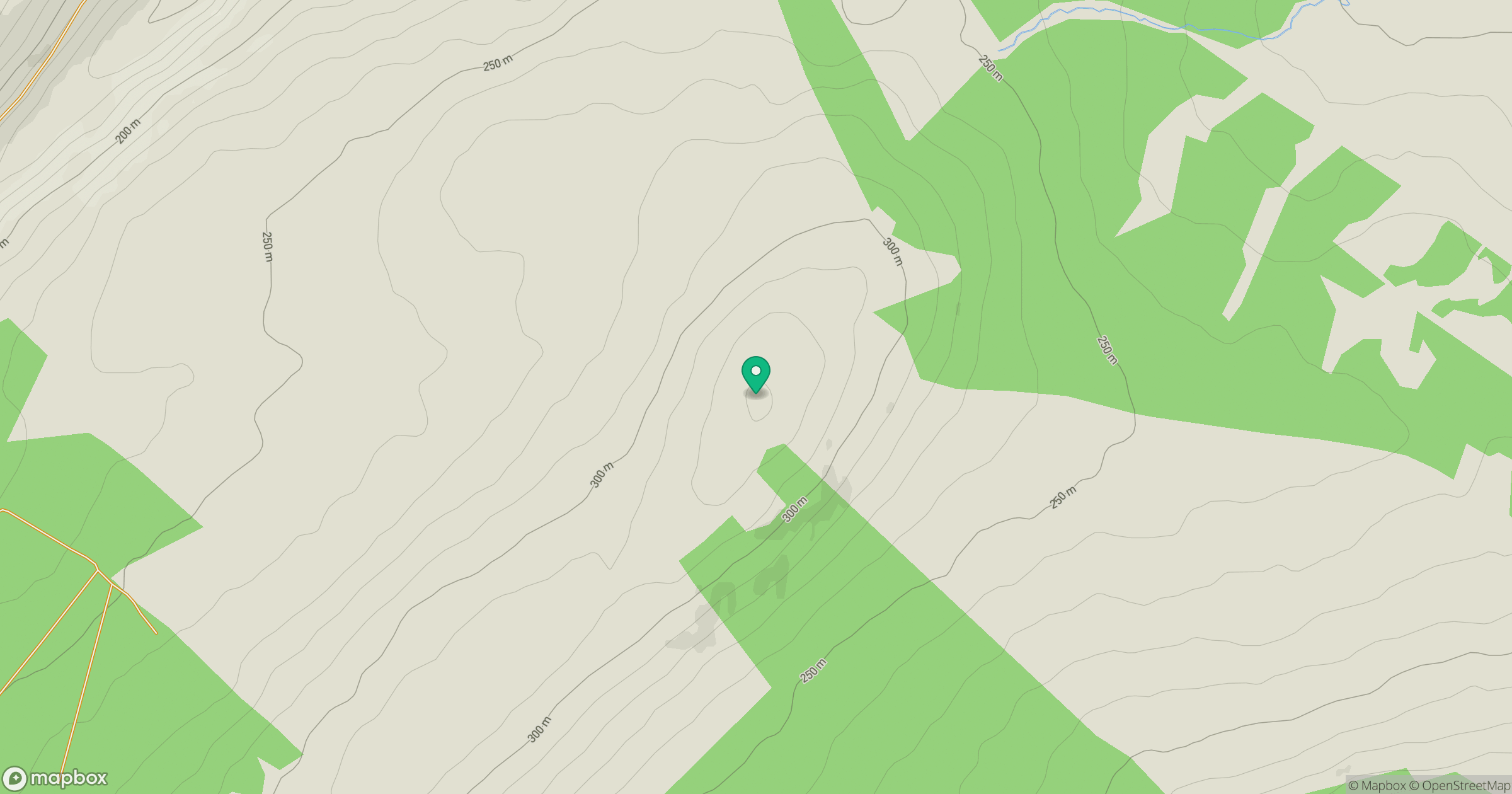
Grid reference: C018102
View on OpenStreetMapOpens a map in a new tab, centred on the hill.
Hills within 30 km
Straight-line distance, not a walking route or confirmation of access.
No comments yet. Be the first.